The UK Ordnance Survey is the national mapping agency for Great Britain. Its maps refer to locations using a grid of easting and northing coordinates (the British National Grid) instead of a graticule of longitude and latitude, but there is an algorithm for converting between …
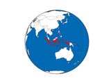
Cartopy is a Python package for geospatial data processing, map production and other geospatial data analyses. This short script plots a map of the world using an orthographic projection and highlights a specified country.
As of April 2020, there were 440 operational nuclear power reactors in the world. They are listed on this Wikipedia page, which can be scraped using the code at the bottom of this post for their important details, including their locations as latitude and longitude …
The UK's Ordnance Survey mapping agency now makes its 50 m resolution elevation data freely-available through its online OpenData download service. This article uses Python, NumPy and Matplotlib to process and visualize these data without using a specialized GIS library. First create a directory, such …
The Earth Impact Database is a collection of images, publications and abstracts that provides information about confirmed impact structures for the scientific community. It is hosted at the Planetary and Space Science Centre (PASSC) of the University of New Brunswick. The code is also presented …